Both in OR, 61 mi apart · 61 mi apart
Beaver Falls vs Multnomah Falls
Two waterfalls in our directory, side by side. Same data we use on the individual pages — height, access, what we know, what we don't.
Oregon
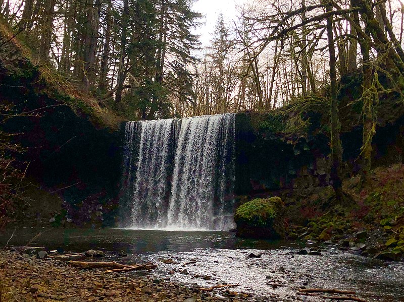
Beaver FallsBeaver Falls is a waterfall in Columbia County, Oregon. It drops roughly 233 feet. Access details and conditions have not yet been verified in person by Fallspots — the data on this page comes from OpenStreetMap and USGS GNIS.
See the full page →
Oregon
Multnomah FallsMultnomah Falls is a waterfall in Oregon. It drops roughly 541 feet. Access details and conditions have not yet been verified in person by Fallspots — the data on this page comes from OpenStreetMap and USGS GNIS.
See the full page →| Spec | Beaver Falls | Multnomah Falls |
|---|---|---|
| State | Oregon | Oregon |
| Height | 233 ft | 541 ft |
| Type | — | tiered |
| Watercourse | Beaver Creek | Multnomah Creek |
| Park | — | — |
| County | Columbia | — |
| Elevation | 106 m | 225 m |
| Nearest city | Clatskanie (4 mi) | North Bonneville (8 mi) |
| Dogs allowed | — | — |
About Beaver Falls
Beaver Falls, is a waterfall located on Beaver Creek near the town of Clatskanie in Columbia County, in the U.S. state of Oregon.
About Multnomah Falls
Multnomah Falls is a waterfall located on Multnomah Creek in the Columbia River Gorge, east of Troutdale, between Corbett and Dodson, Oregon, United States. The waterfall is accessible from the Historic Columbia River Highway and Interstate 84. Spanning two tiers on basalt cliffs, it is the tallest waterfall in the state of Oregon at 620 ft (189 m) in height. The Multnomah Creek Bridge, built in 1914, crosses below the falls, and is listed on the National Register of Historic Places.
Where they are
Dashed line shows the straight-line distance (61 mi). Actual drive time depends on the route — neither pin is the parking lot, so use a map app for turn-by-turn.
Map loads when visible
Related comparisons
Other side-by-side comparisons featuring Beaver Falls or Multnomah Falls.
Annie Falls vs Multnomah Falls
OR · OR
Bridal Veil Falls vs Multnomah Falls
OR · OR
Chush Falls vs Multnomah Falls
OR · OR
Diamond Creek Falls vs Multnomah Falls
OR · OR
Duwee Falls vs Multnomah Falls
OR · OR
Fairy Falls vs Multnomah Falls
OR · OR
Latourell Falls vs Multnomah Falls
OR · OR
Metlako Falls vs Multnomah Falls
OR · OR