Both in Yellowstone National Park, 46 mi apart · 46 mi apart
Bechler Falls vs Upper Yellowstone Falls
Two waterfalls in our directory, side by side. Same data we use on the individual pages — height, access, what we know, what we don't.
Wyoming
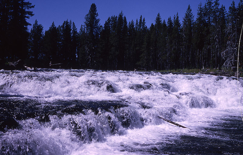
Bechler FallsBechler Falls is a waterfall in Teton County, Wyoming. It drops roughly 15 feet. Access details and conditions have not yet been verified in person by Fallspots — the data on this page comes from OpenStreetMap and USGS GNIS.
See the full page →
Wyoming
Upper Yellowstone FallsUpper Yellowstone Falls is a waterfall in Park County, Wyoming. It drops roughly 108 feet. Access details and conditions have not yet been verified in person by Fallspots — the data on this page comes from OpenStreetMap and USGS GNIS.
See the full page →| Spec | Bechler Falls | Upper Yellowstone Falls |
|---|---|---|
| State | Wyoming | Wyoming |
| Height | 15 ft | 108 ft |
| Type | — | — |
| Watercourse | Bechler River | Yellowstone Falls consist of two major waterfalls on the Yellowstone River |
| Park | Yellowstone National Park | Yellowstone National Park |
| County | Teton | Park |
| Elevation | 1944 m | 2296 m |
| Nearest city | Warm River (15 mi) | Mammoth (20 mi) |
| Dogs allowed | No | No |
About Bechler Falls
Bechler Falls ht. 15 feet (4.6 m) is a waterfall on the Bechler River in Yellowstone National Park. Bechler Falls is the last waterfall on the Bechler River and is approximately 1 mile (1.6 km) from the confluence with the Fall River. It can be reached via the Bechler River trail approximately 3.5 miles (5.6 km) from the Cave Falls trailhead at the south boundary of the park. The falls were named in 1921 by explorers E. C. Gregg and C.H. Birdseye.
About Upper Yellowstone Falls
Yellowstone Falls consist of two major waterfalls on the Yellowstone River, within Yellowstone National Park, Wyoming, United States. As the Yellowstone river flows north from Yellowstone Lake, it leaves the Hayden Valley and plunges first over Upper Falls of the Yellowstone River and then one-quarter mile (400 m) downstream over Lower Falls of the Yellowstone River, at which point it then enters the Grand Canyon of the Yellowstone, which is up to 1,000 feet (300 m) deep.
Where they are
Dashed line shows the straight-line distance (46 mi). Actual drive time depends on the route — neither pin is the parking lot, so use a map app for turn-by-turn.
Map loads when visible
Related comparisons
Other side-by-side comparisons featuring Bechler Falls or Upper Yellowstone Falls.
Amicalola Falls vs Upper Yellowstone Falls
GA · WY
Bechler Falls vs Gibbon Falls
WY · WY
Bechler Falls vs Kepler Cascades
WY · WY
Bechler Falls vs Lewis Falls
WY · WY
Bechler Falls vs Lower Yellowstone Falls
WY · WY
Bechler Falls vs Moose Falls
WY · WY
Bechler Falls vs Mystic Falls
WY · WY
Bechler Falls vs Silver Cord Cascade
WY · WY