Both in MT, 143 mi apart · 143 mi apart
Bird Woman Falls vs Rainbow Falls
Two waterfalls in our directory, side by side. Same data we use on the individual pages — height, access, what we know, what we don't.
Montana
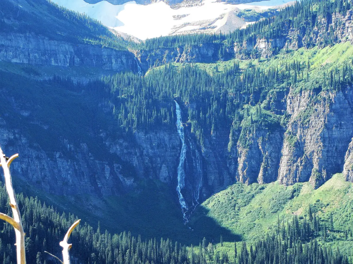
Bird Woman FallsBird Woman Falls drops 560 feet from a hanging valley on Mount Oberlin's east face, visible across the McDonald valley from Going-to-the-Sun Road in Glacier National Park. Flow is heaviest in late June through July as the snowfield above the falls melts. By late August, the falls thin to a wispy trickle. The viewing pullout offers wide-angle photography without leaving the pavement.
See the full page →
Montana
Rainbow FallsRainbow Falls is a waterfall in Cascade County, Montana. It drops roughly 47 feet. Access details and conditions have not yet been verified in person by Fallspots — the data on this page comes from OpenStreetMap and USGS GNIS.
See the full page →| Spec | Bird Woman Falls | Rainbow Falls |
|---|---|---|
| State | Montana | Montana |
| Height | 560 ft | 47 ft |
| Type | horsetail | — |
| Watercourse | Bird Woman Creek | Rainbow Falls is a waterfall on the Missouri River |
| Park | Glacier National Park | — |
| County | Flathead | Cascade |
| Elevation | 1830 m | 974 m |
| Nearest city | West Glacier (18 mi) | Malmstrom AFB (2 mi) |
| Dogs allowed | Yes | — |
About Bird Woman Falls
Bird Woman Falls is a 560 feet (170 m) waterfall located immediately west of the continental divide in Glacier National Park, Montana, United States. The falls are readily visible from a distance of two miles (3.2 km) along the Going-to-the-Sun Road, which bisects the park east to west.
About Rainbow Falls
Rainbow Falls is a waterfall on the Missouri River in Great Falls, Montana, just upstream from Crooked Falls and downstream from Colter Falls and Rainbow Dam. It is 47 feet (14m) high and 1,320 feet (402.3m) wide. The waterfall is part of the five Great Falls of the Missouri. The river spills over a sheer ledge of sandstone in the Kootenai Formation, forming the falls. The falls used to flow with a great deal of force year-round. In 1914 the river shortly upstream was dammed for hydroelectric power by the Rainbow Dam, which forms a run-of-the-river reservoir. As a result, the falls can almost totally dry up in the summer with only a few narrow strips of water trickling down its face. A railroad bridge crosses the river directly above the falls.
Where they are
Dashed line shows the straight-line distance (143 mi). Actual drive time depends on the route — neither pin is the parking lot, so use a map app for turn-by-turn.
Map loads when visible