Both in Yellowstone National Park, 8 mi apart · 8 mi apart
Lewis Falls vs Moose Falls
Two waterfalls in our directory, side by side. Same data we use on the individual pages — height, access, what we know, what we don't.
Wyoming
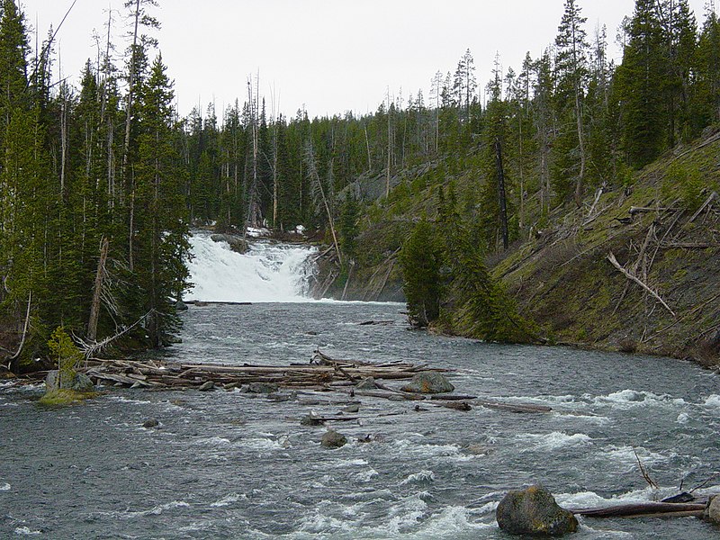
Lewis FallsLewis Falls is a waterfall in Teton County, Wyoming. It drops roughly 30 feet. Access details and conditions have not yet been verified in person by Fallspots — the data on this page comes from OpenStreetMap and USGS GNIS.
See the full page →
Wyoming
Moose FallsMoose Falls is a 30-foot plunge on Crawfish Creek just north of Yellowstone's South Entrance — one of the easiest falls to see in the park. A 75-yard walk from the roadside pullout drops to the base. Named in 1885 by the Arnold Hague Geologic Survey for the moose plentiful in the area. The Crawfish Creek water is geothermally heated from upstream hot springs, so swimming and wading are prohibited. Road closes seasonally in winter.
See the full page →| Spec | Lewis Falls | Moose Falls |
|---|---|---|
| State | Wyoming | Wyoming |
| Height | 30 ft | 30 ft |
| Type | — | plunge |
| Watercourse | The Lewis Falls are located on the Lewis River | Crawfish Creek |
| Park | Yellowstone National Park | Yellowstone National Park |
| County | Teton | Teton |
| Elevation | 2372 m | 2136 m |
| Nearest city | Warm River (35 mi) | Flagg Ranch (2 mi) |
| Dogs allowed | No | No |
About Lewis Falls
The Lewis Falls are located on the Lewis River in Yellowstone National Park, Wyoming, United States. The falls drop approximately 30 feet (9.1 m) and are easily seen from the road, halfway between the south entrance to the park and Grant Village. The falls are on the Lewis River, just south of Lewis Lake.
About Moose Falls
Moose Falls is a plunge type waterfall on Crawfish Creek in Yellowstone National Park. The waterfall was named in 1885 by members of the Arnold Hague Geologic Survey for the plentiful moose found in the southern sections of the park. The falls are just 75 yards (69 m) west of south entrance road via an easy trail that begins 1.2 miles (1.9 km) north of the south entrance station.
Where they are
Dashed line shows the straight-line distance (8 mi). Actual drive time depends on the route — neither pin is the parking lot, so use a map app for turn-by-turn.
Map loads when visible
Related comparisons
Other side-by-side comparisons featuring Lewis Falls or Moose Falls.