Moxie Falls
Maine · height not recorded · Last verified 2026-05-15
Moxie Falls is at 542 cfs of flow today, on the upper end of typical conditions. July averages 4.6" of precipitation here — expect high flow.
Right now
Streamflow
542 cfs
Kennebec River at The · 19m ago
Overnight
62°F
Rain Showers Likely
Friday
79°F
Patchy Fog then Mostly Sunny
Today's daylight
Sunrise 5:01 AM · Sunset 8:28 PM · 15h 27m
Snapshot built 7m ago. Sources: USGS · NWS GYX.
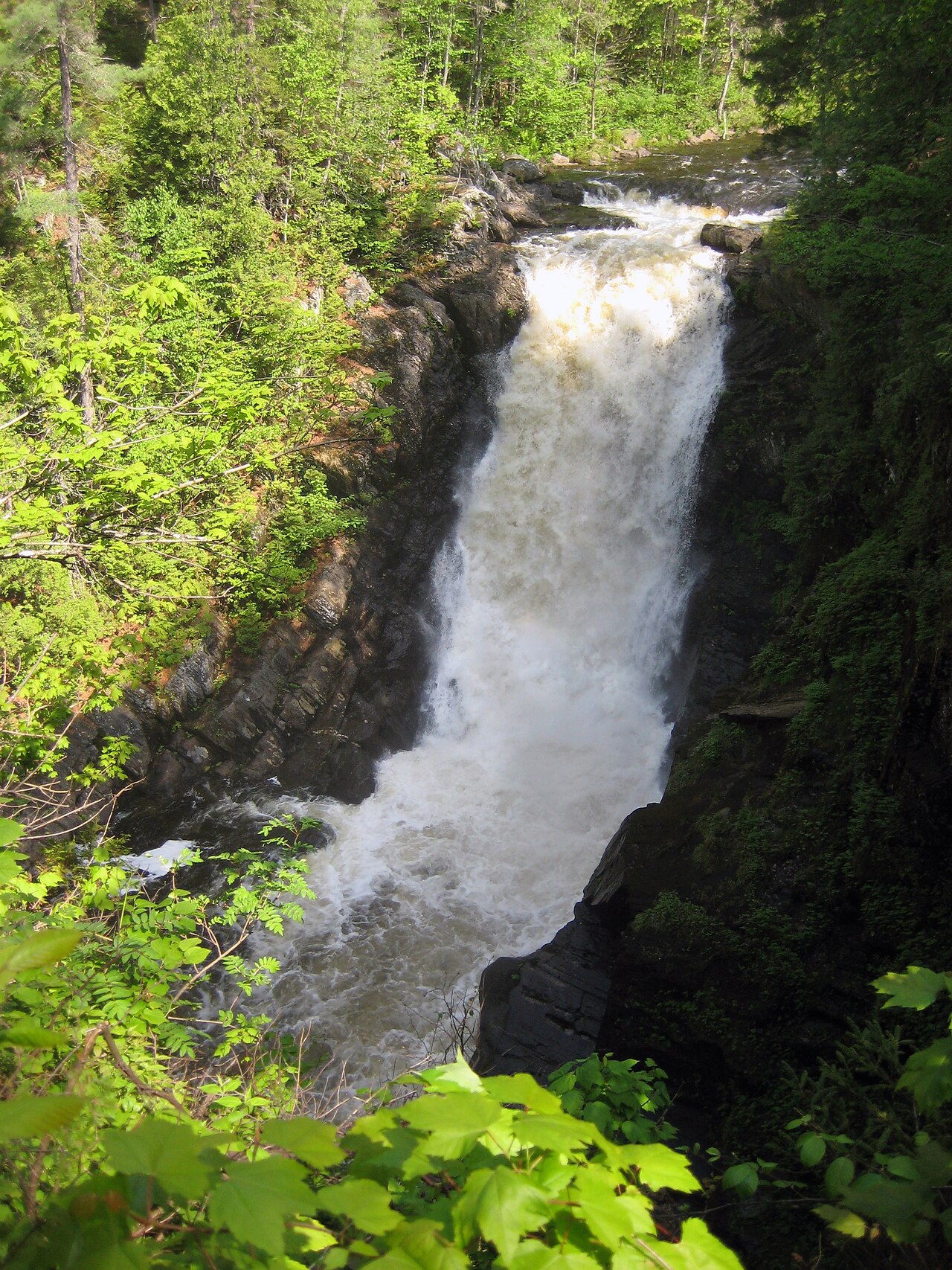
Moxie Falls is a waterfall in Somerset County, Maine. Height has not been officially recorded. Access details and conditions have not yet been verified in person by Fallspots — the data on this page comes from OpenStreetMap and USGS GNIS.
Moxie Falls sits in Somerset County, Maine. It drops along The falls are part of Moxie Stream. The base sits at roughly 840 feet of elevation. Drive time is about 27 minutes from Greenville. OpenStreetMap shows a trail within 40 meters of the marked location, though the name isn't recorded. No public parking is recorded within 2 km, so a longer approach is likely. This is one of the more frequently visited falls in the state by our popularity model. Source records come from OpenStreetMap and USGS GNIS.
Moxie Falls is a waterfall in Somerset County, Maine. At a vertical drop of over 90 feet (30 m) into a pool about 17 feet (5 m) deep, Moxie Falls is one of the highest falls in New England. The falls are part of Moxie Stream which flows from Moxie Pond into the Kennebec River approximately 1 kilometer (0.62 mi) downstream the falls. Moxie Stream drains Moxie Pond approximately 5 miles (8.0 km) upstream of the falls.
Is the water flowing right now?
Most waterfall sites don't tell you this. The waterfall itself is almost never gauged, but a USGS streamgage in the same watershed can tell you whether snowmelt has started, peaked, or run dry.
USGS gage 01042500 · 2 mi away
Kennebec River at The Forks, Maine
View live discharge data →
30-day streamflow
Below 30-day average↻ Same date last year: 1,480 cfs · 177% of last year — significantly wetter
When to go (from the climate data, not our opinion)
Monthly averages from Open-Meteo's reanalysis dataset (2020–2024). Highlighted months are when we think the waterfall is at its best — but the numbers are the numbers regardless.
| Month | High °F | Low °F | Precip (in) | Snow days |
|---|---|---|---|---|
| Jan | 27 | 11 | 3.2 | 18.6 |
| Feb | 29 | 10 | 2.4 | 15.8 |
| Mar | 38 | 21 | 3.3 | 14.6 |
| Apr | 50 | 31 | 4 | 8.8 |
| May | 65 | 43 | 3 | 1 |
| Jun | 73 | 54 | 3.7 | 0 |
| Jul | 78 | 60 | 4.6 | 0 |
| Aug | 76 | 58 | 4.1 | 0 |
| Sep | 69 | 51 | 3 | 0 |
| Oct | 57 | 41 | 3.7 | 1 |
| Nov | 43 | 29 | 3.1 | 8.6 |
| Dec | 33 | 18 | 4.7 | 14 |
Source: Open-Meteo Historical Weather API · ERA5 reanalysis 2020–2024.
Compare to nearby falls
If this one isn't the right fit, here's how it stacks up against the closest documented falls. Every column is filterable on the site — not buried in 13,000 reviews.
| Waterfall | Distance | Height | Trail | Dogs | Fee |
|---|---|---|---|---|---|
| Moxie Falls (this page) | — | — | — | — | — |
| Poplar Hill Falls | 4 mi | — | — | — | — |
| Cold Stream Falls | 8 mi | — | — | — | — |
| Hatch Falls | 14 mi | — | — | — | — |
| Grand Falls | 15 mi | — | — | — | — |
| Long Falls | 16 mi | — | — | — | — |
Questions visitors ask about Moxie Falls
Answers built from our structured data. If a question isn't here, the fact is unverified — we'd rather omit than guess.
How far is Moxie Falls from a major city?
Moxie Falls is 19 miles from Greenville (about 27 minutes' drive).
More waterfalls in Maine
Where it is
45.3625, -69.9370
Sources and live status
Where we got the data, and where to check current conditions before you drive.
Wikipedia
https://en.wikipedia.org/wiki/Moxie_Falls
Wikidata (Q6927506)
https://www.wikidata.org/wiki/Q6927506
GeoNames (4972856)
https://www.geonames.org/4972856/
Last verified by Fallspots: 2026-05-15
Been there?
Marina and Theo verify pages one road trip at a time. If you've been to Moxie Falls recently, your local knowledge improves the page for everyone. Pick the kind of contribution that fits — every email lands in our inbox and gets read (and credited when we publish).
Add a tip
Something we should know — best time, parking trick, that hidden viewpoint.
Share a photo
Have a CC-licensed image on Wikimedia or Flickr? Send the link.
Report a fix
Wrong height, closed trail, broken link — tell us what we got wrong.
We don't collect your email. Replies go directly to hello@fallspots.com.