Snoqualmie Falls
Washington · 269-foot drop · Last verified 2026-05-15
Snoqualmie Falls is at 533 cfs of flow today, on the upper end of typical conditions.
Right now
Streamflow
533 cfs
SNOQUALMIE RIVER NEAR SNOQUALMIE, · 50m ago
Overnight
56°F
Partly Cloudy
Saturday
75°F
Patchy Fog then Mostly Cloudy
Today's daylight
Sunrise 5:35 AM · Sunset 8:51 PM · 15h 16m
Snapshot built 5m ago. Sources: USGS · NWS SEW.
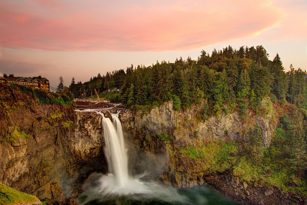
Snoqualmie Falls is a waterfall in King County, Washington. It drops roughly 269 feet. Access details and conditions have not yet been verified in person by Fallspots — the data on this page comes from OpenStreetMap and USGS GNIS.
Snoqualmie Falls sits in King County, Washington. It drops along Seattle on the Snoqualmie River. The base sits at roughly 561 feet of elevation. Drive time is about 2 minutes from Snoqualmie. OpenStreetMap shows a trail within 120 meters of the marked location, though the name isn't recorded. No public parking is recorded within 2 km, so a longer approach is likely. This is one of the more frequently visited falls in the state by our popularity model. Source records come from OpenStreetMap and USGS GNIS.
Snoqualmie Falls is a 268-foot (82 m) waterfall in the northwest United States, located east of Seattle on the Snoqualmie River between Snoqualmie and Fall City, Washington. It is one of Washington's most popular scenic attractions and is known internationally for its appearance in the television series Twin Peaks. More than 1.5 million visitors come to the Falls every year, where there is a two-acre park, an observation deck, and a gift shop.
Is the water flowing right now?
Most waterfall sites don't tell you this. The waterfall itself is almost never gauged, but a USGS streamgage in the same watershed can tell you whether snowmelt has started, peaked, or run dry.
USGS gage 12144500 · 0.3 mi away
SNOQUALMIE RIVER NEAR SNOQUALMIE, WA
View live discharge data →
30-day streamflow
Below 30-day average↻ Same date last year: 463 cfs · 118% of last year — similar
Live webcams
Operated by the park or a local utility — check current conditions before driving.
Compare to nearby falls
If this one isn't the right fit, here's how it stacks up against the closest documented falls. Every column is filterable on the site — not buried in 13,000 reviews.
| Waterfall | Distance | Height | Trail | Dogs | Fee |
|---|---|---|---|---|---|
| Snoqualmie Falls (this page) | — | 269 ft | — | — | — |
| Fantastic Falls | 5 mi | 33 ft | — | — | — |
| Teneriffe Falls | 7 mi | — | — | — | — |
| Fifteenmile Waterfall | 8 mi | — | — | — | Free |
| Twin Falls (Lower) | 9 mi | 230 ft | — | Y | Free |
| Twin Falls (Upper) | 9 mi | — | — | Y | Free |
Side-by-side comparisons
Snoqualmie Falls compared head-to-head with other documented falls — height, access, fees, dogs, swimmability in one row each.
Related waterfalls
Similar height (~269 ft)
- Mackintosh Falls266 ft
- Greenleaf Falls262 ft
- Roaring Brook Falls262 ft
- Tribulation Falls277 ft
- Buttermilk Falls279 ft
Questions visitors ask about Snoqualmie Falls
Answers built from our structured data. If a question isn't here, the fact is unverified — we'd rather omit than guess.
How tall is Snoqualmie Falls?
Snoqualmie Falls is 269 feet (82 m) tall. Source heights disagree by source — see the discrepancy box on the page.
How far is Snoqualmie Falls from a major city?
Snoqualmie Falls is 1 miles from Snoqualmie (about 2 minutes' drive).
More waterfalls in Washington
Where it is
47.5416, -121.8379
Sources and live status
Where we got the data, and where to check current conditions before you drive.
Wikipedia
https://en.wikipedia.org/wiki/Snoqualmie_Falls
Wikidata (Q7548048)
https://www.wikidata.org/wiki/Q7548048
GeoNames (5810998)
https://www.geonames.org/5810998/
Last verified by Fallspots: 2026-05-15
Been there?
Marina and Theo verify pages one road trip at a time. If you've been to Snoqualmie Falls recently, your local knowledge improves the page for everyone. Pick the kind of contribution that fits — every email lands in our inbox and gets read (and credited when we publish).
Add a tip
Something we should know — best time, parking trick, that hidden viewpoint.
Share a photo
Have a CC-licensed image on Wikimedia or Flickr? Send the link.
Report a fix
Wrong height, closed trail, broken link — tell us what we got wrong.
We don't collect your email. Replies go directly to hello@fallspots.com.