Both in Yellowstone National Park, 3 mi apart · 3 mi apart
Silver Cord Cascade vs Upper Yellowstone Falls
Two waterfalls in our directory, side by side. Same data we use on the individual pages — height, access, what we know, what we don't.
Wyoming
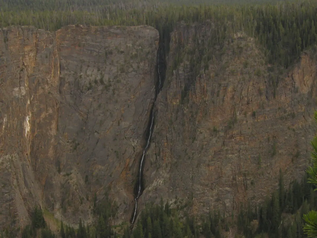
Silver Cord CascadeSilver Cord Cascade is the tallest waterfall in Yellowstone National Park, dropping 1,214 feet down the north wall of the Grand Canyon of the Yellowstone. The view is from across the canyon — there is no access to the base. The cascade is best seen from the Ribbon Lake Trail, a short walk from Glacial Boulder. Flow peaks in May and June with snowmelt and thins steadily through summer.
See the full page →
Wyoming
Upper Yellowstone FallsUpper Yellowstone Falls is a waterfall in Park County, Wyoming. It drops roughly 108 feet. Access details and conditions have not yet been verified in person by Fallspots — the data on this page comes from OpenStreetMap and USGS GNIS.
See the full page →| Spec | Silver Cord Cascade | Upper Yellowstone Falls |
|---|---|---|
| State | Wyoming | Wyoming |
| Height | 1,214 ft | 108 ft |
| Type | horsetail | — |
| Watercourse | Surface Creek | Yellowstone Falls consist of two major waterfalls on the Yellowstone River |
| Park | Yellowstone National Park | Yellowstone National Park |
| County | Park | Park |
| Elevation | 2380 m | 2296 m |
| Nearest city | Canyon Village (4 mi) | Mammoth (20 mi) |
| Dogs allowed | No | No |
About Silver Cord Cascade
Silver Cord Cascade is a horsetail type waterfall on Surface Creek, a tributary of the Yellowstone River in Yellowstone National Park. Surface Creek flows out of Ribbon Lake off the South rim of the Grand Canyon of the Yellowstone and plunges 1,200 feet (370 m) to the Yellowstone River. It is considered one of the tallest waterfalls in Yellowstone.
About Upper Yellowstone Falls
Yellowstone Falls consist of two major waterfalls on the Yellowstone River, within Yellowstone National Park, Wyoming, United States. As the Yellowstone river flows north from Yellowstone Lake, it leaves the Hayden Valley and plunges first over Upper Falls of the Yellowstone River and then one-quarter mile (400 m) downstream over Lower Falls of the Yellowstone River, at which point it then enters the Grand Canyon of the Yellowstone, which is up to 1,000 feet (300 m) deep.
Where they are
Dashed line shows the straight-line distance (3 mi). Actual drive time depends on the route — neither pin is the parking lot, so use a map app for turn-by-turn.
Map loads when visible
Related comparisons
Other side-by-side comparisons featuring Silver Cord Cascade or Upper Yellowstone Falls.
Amicalola Falls vs Upper Yellowstone Falls
GA · WY
Bechler Falls vs Silver Cord Cascade
WY · WY
Bechler Falls vs Upper Yellowstone Falls
WY · WY
Bridalveil Fall vs Upper Yellowstone Falls
CA · WY
Chilnualna Fall vs Upper Yellowstone Falls
CA · WY
Depot Creek Falls vs Upper Yellowstone Falls
WA · WY
Gibbon Falls vs Silver Cord Cascade
WY · WY
Gibbon Falls vs Upper Yellowstone Falls
WY · WY