Sulphide Creek Falls
Washington · 3,937-foot drop · North Cascades National Park · Last verified 2026-05-14
Flow at Sulphide Creek Falls is 479 cfs today, around its seasonal average.
Right now
Streamflow
479 cfs
BAKER RIVER AB BLUM · 51m ago
Overnight
53°F
Slight Chance Light Rain
Tuesday
61°F
Chance Showers And Thunderstorms
Today's daylight
Sunrise 5:34 AM · Sunset 8:51 PM · 15h 17m
Other park alerts
Snapshot built 5m ago. Sources: USGS · NWS SEW.
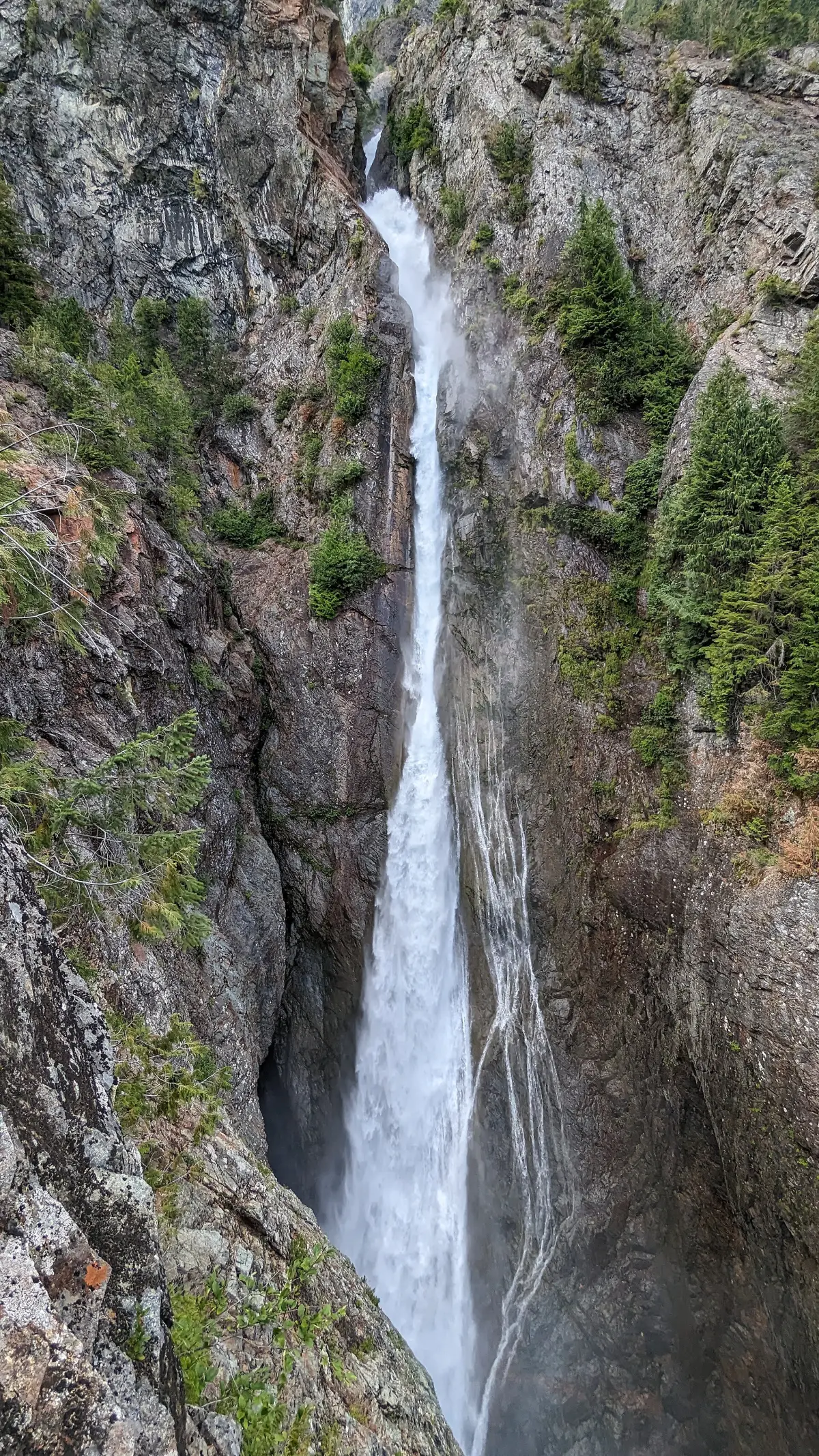
Sulphide Creek Falls is one of the tallest waterfalls in the United States. It is also one of the hardest to see. There is no maintained trail. The fall is glacier-fed and most reliably visible in mid-summer after snowmelt clears the upper basin.
Sulphide Creek Falls sits in Whatcom County, Washington. It drops along Sulphide Creek. The falls are inside North Cascades National Park, a US National Park. The base sits at roughly 3,500 feet of elevation. Drive time is about 78 minutes from Bellingham. Source records come from OpenStreetMap and wikidata:Q37249 and wikipedia:Sulphide_Creek_Falls.
There's a $30 fee at the trailhead or park gate. Dogs are not allowed on the access trail or at the falls. Parking: Trailhead access varies by approach. Permits required for overnight.. Swimming is not recommended — no water access; viewable only from distant overlook Best viewing window: 7 through 9.
Sulphide Creek Falls is a tall, moderately large volume waterfall within North Cascades National Park in Washington state that is one of the tallest waterfalls in North America. The falls drop from Sulphide Lake on the southeast side of Mount Shuksan down a narrow flume-like canyon to a broad basin below.
A short history
First named in USGS records in the early 20th century after the sulfur springs that feed the creek's headwaters.
The trail
There is no maintained trail. Reaching the falls requires backcountry travel and route-finding.
Why the waterfall is there
The falls drop over Shuksan Greenschist — metamorphic rock formed roughly 130-170 million years ago and uplifted by the same tectonic activity that built the North Cascades. The cascade exists because Sulphide Lake sits at the lip of a hanging valley carved by Pleistocene glaciation.
- Rock type
- Shuksan Greenschist
- Formation age
- Jurassic metamorphic basement; glacial sculpting Pleistocene
Source: USGS Geologic Map of North Cascades NP
Is the water flowing right now?
Most waterfall sites don't tell you this. The waterfall itself is almost never gauged, but a USGS streamgage in the same watershed can tell you whether snowmelt has started, peaked, or run dry.
USGS gage 12190400 · 9 mi away
Baker River ab Blum Creek nr Concrete, WA
Baker River — downstream watershed proxy; Sulphide Creek itself is ungauged
View live discharge data →
30-day streamflow
Near 30-day average↻ Same date last year: 351 cfs · 154% of last year — significantly wetter
Compare to nearby falls
If this one isn't the right fit, here's how it stacks up against the closest documented falls. Every column is filterable on the site — not buried in 13,000 reviews.
| Waterfall | Distance | Height | Trail | Dogs | Fee |
|---|---|---|---|---|---|
| Sulphide Creek Falls (this page) | — | 3,937 ft | no trail | N | $30 |
| Rainbow Falls | 5 mi | 157 ft | — | Y | Free |
| Lower Morovitz Falls | 5 mi | — | — | Y | Free |
| Upper Morovitz Falls | 5 mi | — | — | Y | Free |
| Berdeen Falls | 8 mi | 899 ft | — | N | — |
| Goat Falls | 8 mi | 282 ft | — | N | — |
Side-by-side comparisons
Sulphide Creek Falls compared head-to-head with other documented falls — height, access, fees, dogs, swimmability in one row each.
Related waterfalls
Same best season in Washington
- Carter Falls53 ft
- Hamma Hamma Falls75 ft
- Panther Creek Falls136 ft
- Dougan Falls19 ft
- Cherry Creek Falls25 ft
Questions visitors ask about Sulphide Creek Falls
Answers built from our structured data. If a question isn't here, the fact is unverified — we'd rather omit than guess.
How tall is Sulphide Creek Falls?
Sulphide Creek Falls is 3,937 feet (1200 m) tall. Source heights disagree by source — see the discrepancy box on the page.
Is Sulphide Creek Falls in a national or state park?
Yes — Sulphide Creek Falls is inside North Cascades National Park. See the park page for fees, hours, and current conditions.
Can I bring my dog to Sulphide Creek Falls?
No — dogs are not allowed on trails here. Most National Park trails prohibit pets to protect wildlife. Service animals are an exception per ADA.
Can you swim at Sulphide Creek Falls?
No — swimming is not safe or not allowed at Sulphide Creek Falls. no water access; viewable only from distant overlook
When is the best time to visit Sulphide Creek Falls?
Peak flow is typically July, August, September. Season-wise: summer. Snowmelt and recent rain affect day-to-day volume.
Is there a fee to visit Sulphide Creek Falls?
Yes — entry costs around $30. Most North Cascades National Park entrances accept the America the Beautiful annual pass.
How far is Sulphide Creek Falls from a major city?
Sulphide Creek Falls is 38 miles from Bellingham (about 78 minutes' drive).
More waterfalls in Washington
Where it is
48.7983, -121.5762
Sources and live status
Where we got the data, and where to check current conditions before you drive.
Official land manager
https://www.nps.gov/noca/
Wikipedia
https://en.wikipedia.org/wiki/Sulphide_Creek_Falls
Wikidata (Q37249)
https://www.wikidata.org/wiki/Q37249
North Cascades NP conditions
https://www.nps.gov/noca/planyourvisit/conditions.htm
Last verified by Fallspots: 2026-05-14
Been there?
Marina and Theo verify pages one road trip at a time. If you've been to Sulphide Creek Falls recently, your local knowledge improves the page for everyone. Pick the kind of contribution that fits — every email lands in our inbox and gets read (and credited when we publish).
Add a tip
Something we should know — best time, parking trick, that hidden viewpoint.
Share a photo
Have a CC-licensed image on Wikimedia or Flickr? Send the link.
Report a fix
Wrong height, closed trail, broken link — tell us what we got wrong.
We don't collect your email. Replies go directly to hello@fallspots.com.